The Quilotoa Loop

The Road Chose Me Volume 2 OUT NOW!!
The Road Chose Me Volume 2: Three years and 54,000 miles around Africa
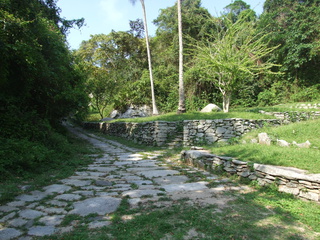
I’m happy to be out of the big city, a journey that took a little longer than expected, and stop for a couple of days just off the Pan American highway near Volcán Cotopaxi at a working farm called Hosteria Papagayo. I go for a huge hike into the hills behind, continuously gaining elevation, though the continuous cloud cover means I don’t get so much as a glimpse of the snow-capped mountains I know are all around me.

My 'friends' who joined me for lunch at Papagayo
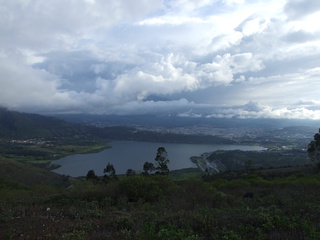
I set out on the famous Quilotoa Loop not entirely sure what to expect and am immediately in awe of the scenery and little villages I constantly pass though. This tiny road winds it’s way through communities high in the the Andean mountains which I imagine have been much the same for hundreds of years. The highlight is by far Laguna Qilotoa, formed in the crater of an enormous inactive volcano at 3,800 meters elevation. A local guy lets me camp on his property about 5 meters from the edge of the rim, one of my better campsites for sure. Hiking around the rim the next morning takes about four and a half hours with some seriously impressive views along the way.

The endless green hills of the Quilotoa Loop

The full Laguna Quilotoa
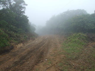
I drive further and further along the deteriorating track, to the little town of Chugchilán. There are a couple of tiny stores, two hosterias and some street vendors selling suspicious looking meat on the one and only street in town. I check-in to one of the hosterias, with a private room, hot shower, dinner and breakfast all for $10 and set out to explore. After walking the length of town twice in five minutes, I venture up into the surrounding hills with no exact destination in mind. As I’ve come to expect the thick clouds roll in around lunchtime and there is a steady stream of rain for the remainder of the day. Although there is nothing to do per se, I come to like this little town and the friendly people going about their lives.

Iliniza Sur and Norte snuck out for just a minute

The trail around the entire rim
I finish the loop the next day by wandering around Saquisili, reported to have the ‘most authentic’ market in Ecuador. Indigenous people hike into town from miles around often using Llamas to pack their produce and hand made goods in and out. It’s not at all geared for tourists and is the lifeblood of the many communities in the area.
At least, this is what I’ve read.
The market is a Thursday-only affair and I’ve arrived on a Saturday. Maybe I’ll come back.

Just hanging out on the side of Laguna Quilotoa

On the rim of Laguna Quilotoa at my campsite
I still don’t know what that suspicious looking meat was, but it tasted pretty good 
-Dan


Man that second to last picture looks very steep — and quite a fall down into the lake.
Oh yeah, you bet