Portage Brûlé Hot Spring

The Road Chose Me Volume 2 OUT NOW!!
The Road Chose Me Volume 2: Three years and 54,000 miles around Africa
Today’s update is written in the style of my favorite guide book (no points for guessing which one…)
Portage Brûlé Hot Spring
up to 48 ˚C (118 ˚F)
These seldom visited springs are situated on the north shore of the Liard River about 3 kms (2 mi.) downstream from the mouth of the Coal River. Round-trip hiking time is around 4 hours and may be longer if the water level in the Liard is high.
Getting There
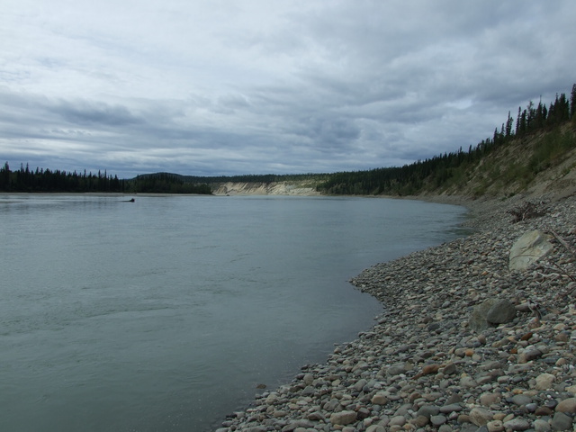
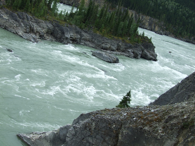
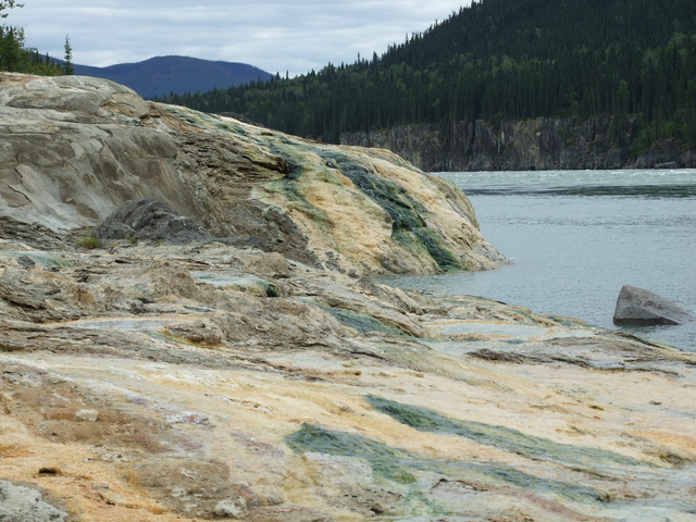
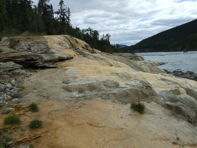
Coal River is 65 km North of Liard Hot Springs on the Alaska Highway. From the general store, drive 8.2 km (5 mi.) south on the Alaska Highway to a large pull-out with a big black sign. From here, walk or drive 1.3 km (1 mi.) north to a large culvert running down to the nearby Liard. Walk down the culvert to the Liard and hike about 2.5 km (1.6 mi.) upstream along the shoreline to the Portage Brûlé Rapids. 20 meters (60 ft.) before the rapids, rock cliffs will force you up onto the Portage trail which may be marked by flagging tape and is kept in useable condition by paddling enthusiasts. Continue along the trail which hugs the cliff edge for approx. 1.5 km (1 mi.) looking out for yellow colored limestone and tufa just above the waterline below. Hiking time from the highway to the springs is about 2 hours.
Alternate Approach
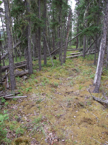
When the Liard is running high, there is little to no bank in many places, making it impossible to reach the rapids. I’m told an overgrown trail exists from the end of the airstrip behind the Coal River general store to the springs. I don’t know how difficult the bush whacking is and I was told numerous times this area is very popular with bear sows and cubs.
The Springs
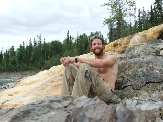
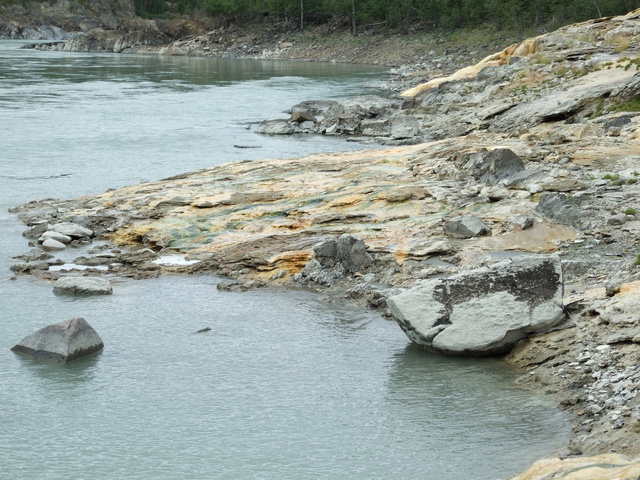
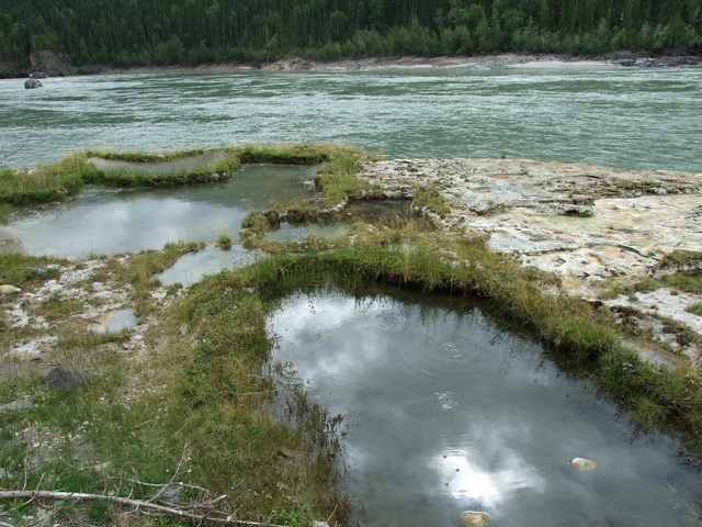
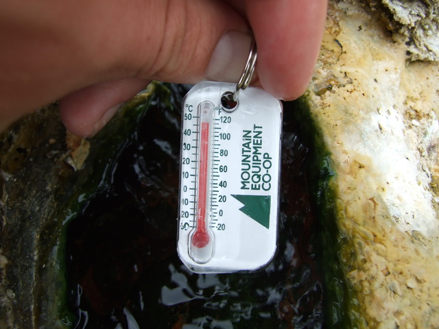
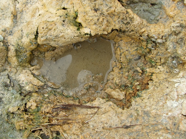
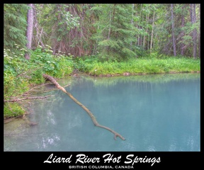
As many as 15 seeps issue from bedrock along about 300 meters (1000 ft.) of river bank between the Liard and a clay bank above. Many of the springs begin in large pools and have formed tufa terraces and mounds as they flow into the Liard. The best pool, formed from hardened tufa is about 3 meters (10 ft.) across by 1 meter (3 ft.) deep. Hot water (about 39 ˚C (102 ˚F)) swells up from the algae-covered bottom. Two nearby vents with good flow rates are 48 ˚C (118 ˚F). Many of the hottest springs were on the waterline so it’s very likely more were underwater at the time of my visit.
The spring water is colorless and odorless and gas bubbles from many of the springs.
Comments
Beware of rock slides as you walk along the bank of the Liard, it’s very steep and doesn’t leave much room for error.
-Dan


Is the water safe to drink?
For sure, this water has come from a long way down and is very very clear and filtered.
I didn’t actually drink from this spring, but I did a lot at Deer River.
Hey! Just read what you wrote on my blog! Thanks for reading.
If you are coming anywhere near Northern Cali, let me know. I’d love to have someone hike Half Dome with me in Yosemite. What a sight that’d be, right?
Sweet Catherine, I’ve heard great things about half-dome and it’s high on my list.
I’ll let you know when I’m around that area for sure!
DAN THE MAN! I cannot get enough of your exploits, both present and past. I have been planning a trip up to the Liard area next year, and hope to do some serious soaking. These particular hot springs are on the list, and your directions are WICKED! I have to ask, how was the soaking at portage brule? Quality of the pools? I am sure I can read all about in Glenn Woodsworths 3rd edition(whenever that comes out), but if you had the time, I’d love for you to fill me in on everything you can for this area of BC.
Hey Soakmonster – glad to hear you’re enjoying my stories

The soaking at PB was not first class, but good for sure. It’s an extremely beautiful area, very peaceful and I’ll bet $100 you won’t see another person.
At the time of my visit there was one pool plenty big enough for soaking, and maybe a touch too cold for an extended soak, though well worth getting in.
The tufa mounds and the whole area is extremely beautiful and I spent a few hours just exploring around, checking all the different hot water vents and enjoying the amazing place.
I wonder when the 3rd ed is coming out… some of my directions should be in there
All the best, enjoy the north, it’s extremely beautiful.
-Dan
Dan!
Wow, I feel truly privledged to have you reply personally to my post. You are quickly becoming somewhat of a legend in my mind, your life reflects something that I have fantasized about for much of my life. I am nearing 25 now, and starting to think the last 5 years of my life could have been spent doing much more than chasing the capitalist dream. I am looking at a few months of downtime from work for the first time since I graduated, unfortunatly it is all winter months, perhaps a ski tour of BC is in order.
I have already solidified plans to hit up Dewar Creek hot springs and the St Mary pass next august (on august long, hope there isnt too many other visitors to the springs). Have you been to these springs as well? Also, you mention some of your directions will be in the 3rd ed…am I out of place to ask if “THE” (deer river) directions will be in there? I would love to visit the springs, and solid directions could make doing the 16 hour drive a little less nerve racking, knowing that I wouldn’t be doing it all to walk blindly up the (west?) banks of the deer river, looking for “out-of-place, white cliffs”. On the other hand, doing the trek only to find a multitude of trees cut down for firewood and an ever growing collection of beer cans at such a secluded and beautiful place would not be cool. So instead of asking how you got there, I will only ask how to begin looking?
Thank you Dan for your prompt reply, your specific details, and most of all, your stories. If you should ever find yourself in the Okanagan area of BC, look us up, for a free meal and a free bed, or just an interesting cup of coffee. I am originally from the central interior, and could probably hook a weary traveller up with somewhere to lay his head there as well.
HAPPY TRAILS!
Chris
Hey Chris, Great to hear from you man.
No, no, I’m not any kind of legend, just a guy that want’s to get out there an live life that’s all.
I’m 28 myself, actually an Engineer and just decided that going to work for the rest of my life is not what I want to do. Obviously I need to work for rent and food, but not for cell phones and big screen TVs. It really is just a choice if you so choose it.
Dewar Creek is an excellent hot spring, possibly my all-time favorite (top 5 for sure). I’ve been in the summer, and day hiked in with my brother in the early winter through shin deep snow.
Check it out: Dewar Creek in summer and Dewar Creek in winter.
With regards to Deer River hot springs, no the directions will not be in the book. Glenn and I decided it’s best not to publish them, let the adventurous discover them.
My brother lives in Nelson, BC now, so I’m certain I’ll be back in that part of the world sooner or later.
Good luck Chris, enjoy exploring BC, it really is beautiful.
-Dan
Dan!
First and foremost, CONGRATS TO YOU AND YOUR JEEP FOR SURVIVING THE TREK TO CHILE! You have truly pushed the limits of your adventure, and I am so stoked to be there to read all about it. What a constructive use of the internet! FLAMINGOS DON’T START OFF PINK?!?! HOLY *&%! How can I have lived this long and never learned that? Wow, Exciting and educational!
AH HA! Of course you have been to Dewar Creek, during two seasons none the less! Superlative…I like it! Your trip reports on Dewar coupled with our on-going correspondance have psyched me for my impending trip next August more than ever. I am tempted to throw the snow shoes on and head out right now! The idea of soaking my way there is intriguing, even if some of the springs are popular and/or commercialized.
I am happy to hear yourself and Mr. Woodsworth have decided to keep the directions to Deer River unpublished, when I am closer to the Liard area, I will probably spam your blog relentlessly for advice, so let me apologize in advance (j/k) Awesome accomplishment you have made by visiting this place!
Keep on trekking man: if not a legend, than you are at the very least, an inspiration,
Thanks for keeping us all posted,
Chris
Although we have been hot springs aficionados for about 50 years, we are approaching our 80’s and a little less energetic. We intend to drive north thru western BC from Port Townsend, WA to Watson Lake via Prince George and Hwy 37, with several side trips. We have not done this route for several years.
My question is this: are there any undeveloped hot springs accessible by road, or within a 1km hike ? We plan this trip to begin mid-August.
Thanks for your time and attention. Norm & Max
Hey Norm and Max,
I don’t know of any hot springs off highway 37, though there are quite a few around Price Rupert if you want to detour that far. Checkout the guidebook “Hotsprings of Western Canada” for the details.
Portage Brûlé Hot Spring is about ~1.5 hours south of Watson Lake, although it’s quite the walk to get there.
Have fun!
-Dan
We made it today and it was amazing. We used your directions and it was easy to find. Didn’t do any soaking because it is winter and sub zero temperature but we did take it all in. The walk in the winter is stunning.
Hey Riley,
Thanks for the note! Lots of snow up there? did you scramble right next to the Liard, or up on the bank a little?
I would love to get in there in winter, but I assume it’s not quite warm enough for a soak.
-Dan
Hey Dan, I walked along the ice on the river edge and my friend was not in to that so she walked along the rocks. The one pool that is kinda high up on the bank probably would be a decent soak in the winter but we also left fairly late in the day and we just wanted to get back safe. If we would have left early in the morning we probably could have done a soak in that one upper pool. The river was in low water I assume. We did see fairly fresh wolf tracks.
Hi Dan or everyone else who has been to these springs,
Thanks for this story! Do you happen to have gps coordinates for these springs?? I might go try to find them this weekend and would not mind using gps:) Thanks for any info!!
Cheers, Denise
Hi Denise,
I went to these springs before I carried a GPS, so unfortunately I don’t.
If you can get to the rapids, then follow the trail, they would be hard to miss!
Good luck!
-Dan